
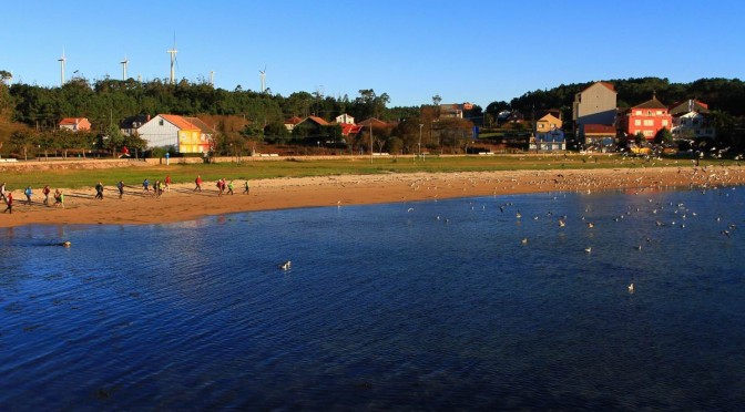
The sixth section is the longest of this trail but it is also totally flat. We will cross the entire Ría de Camariñas, with softer landscapes and beautiful villages that will give us another point of view on the route. In the second part, quiet sandy areas of the mouth of the Rio Grande and the wonderful Praia do Lago bring us closer to Muxía, where we will arrive at the Barca Sanctuary after the ascent to Corpiño Mount. About ten hours of section before ending at Praia do Coido.
Download the track of the stage at Google Maps or Wikiloc


PLANNING SECTION 6 (it´s given in kilometers)
| POINT | KME | HOUR | DIF | PEL | AGU | TIME | KMM |
|---|---|---|---|---|---|---|---|
| SECTION 6: CAMARIÑAS – MUXIA (32,6 Km) | 2 | 10h | 115.5 | ||||
| Subsection 6-1: Fishing port in Camariñas – Tasaraño (9,1 Km) | 1 | 0 | 30′ | 115.5 | |||
| Departure Curbeiro Square | 0 | 115.5 | |||||
| Area da Vila Beach | 1.4 | 10:15 | FUE | 116.9 | |||
| Lingunde Beach | 1.9 | 10:30 | 117.4 | ||||
| Basa Inlet | 2.1 | 2 | 117.6 | ||||
| Turn right Parrillada Rojo Xaviña | 4.4 | 11:15 | 119.9 | ||||
| Head-on crossing | 5.8 | 121.3 | |||||
| Punta Sandria | 7.1 | 122.6 | |||||
| Ariño pine grove | 7.8 | 123.3 | |||||
| Ariño Beach | 7.8 | 12:00 | FUE | 123.3 | |||
| Crossing of Ariño | 9 | 12:15 | 1 | 124.5 | |||
| Tasaraño | 9.1 | BAR | 124.6 | ||||
| Subsection 6-2: Tasaraño – Cereixo (5,5 Km) | 1 | 0 | 45’+30′ | 124.6 | |||
| Tasaraño spring water | 9.2 | FUE | 124.7 | ||||
| Dor | 10.1 | 125.6 | |||||
| Crossing Dor Forest | 11 | 126.5 | |||||
| O Allo | 11.7 | 13:15 | 127.2 | ||||
| Ponte do Porto | 12.9 | 13:30 | BAR | 128.4 | |||
| Turn right to Cereixo | 14.1 | 13:45 | 1 | 129.6 | |||
| Tidal mill of Cereixo | 14.2 | 129.7 | |||||
| Church of Santiago de Cereixo | 14.5 | 130.0 | |||||
| Cereixo Towers | 14.5 | 130.0 | |||||
| Oak of Cereixo (30′ avit) | 14.5 | 14:00 | 30′ | 130.0 | |||
| Subsection 6-3: Cereixo – Lago Beach (6,8 Km) | 2 | 1 | 120’+30 | 130.0 | |||
| Cereixo Cemetery | 14.9 | 130.4 | |||||
| Turn right Lago Beach road | 15.1 | 3 | 130.6 | ||||
| Turn right Furna do Sapo | 15.3 | 14:45 | 130.8 | ||||
| Furna do Sapo | 15.9 | 15:00 | 131.4 | ||||
| Prado de Leis | 16.5 | 132.0 | |||||
| Vilariño stream | 16.9 | 132.4 | |||||
| Area Grande Beach | 17.4 | 15:15 | 132.9 | ||||
| Turn right Leis Beach | 19.3 | 134.8 | |||||
| Leis Beach | 19.9 | 16:00 | 1 | 135.4 | |||
| Punta do Lago Lighthouse | 20.5 | 16:15 | 136.0 | ||||
| Lago Beach | 21.4 | 136.9 | |||||
| Pine grove Lago Beach (30′ stop) | 21.4 | 16:30 | BAR | 30′ | 136.9 | ||
| Subsection 6-4: Lago Beach – Os Muiños (3,9 Km) | 0 | 0 | 45′ | 136.9 | |||
| Bridge of Lago River | 21.6 | 17:00 | 137.1 | ||||
| Turn right end of Lago Beach | 21.8 | 137.3 | |||||
| Turn right to road | 22.4 | 137.9 | |||||
| Turn left to Merexo | 22.6 | 138.1 | |||||
| Merexo | 22.7 | 17:15 | 138.2 | ||||
| Roadside Merexo-Os Muiños | 23.5 | 17:30 | 2 | 139.0 | |||
| Turn right Os Muiños | 25.1 | 140.6 | |||||
| Os Muiños | 25.3 | 17:45 | 140.8 | ||||
| Subsection 6-5: Os Muiños – Punta da Cruz (4,5 Km) | 2 | 2 | 60′ | 140.8 | |||
| Tella spring water | 25.4 | FUE | 140.9 | ||||
| Negro River Mills | 25.5 | 141.0 | |||||
| Turn left end of path of Negro River Mills | 26 | 141.5 | |||||
| Muiños Beach | 26.5 | 18:00 | 142.0 | ||||
| Exit Muiños Beach | 27 | 142.5 | |||||
| Chorente | 27.9 | 18:15 | 143.4 | ||||
| Espiñeirido Beach | 28.9 | 18:30 | 144.4 | ||||
| Cruz Beach | 29.7 | 145.2 | |||||
| Subsection 6-6: Punta da Cruz – Coido Beach (2,8 Km) | 1 | 0 | 60’+15′ | 145.2 | |||
| Nautical port Marina Muxía | 29.7 | 18:45 | 145.2 | ||||
| Muxía Square | 30.2 | BAR | 145.7 | ||||
| Church of Santa María | 30.6 | 146.1 | |||||
| Corpiño Mount | 30.7 | 19:00 | 146.2 | ||||
| Muxia Lighthouse | 31.3 | 19:15 | 146.8 | ||||
| Pedra de Abalar Stone & Pedra dos Cadrís Stone | 31.4 | 146.9 | |||||
| Punta da Barca | 31.4 | 146.9 | |||||
| Sanctuary Virxe da Barca (15′ stop) | 31.4 | 19:15 | 15′ | 146.9 | |||
| Monument A Ferida | 31.5 | 19:30 | 147.0 | ||||
| Conger eel drying shed | 32.4 | 147.9 | |||||
| Coido Beach | 32.6 | 20:00 | 148.1 | ||||
KME – Kilometers of the section
TIME – The schedule that appears in the documentation is the perfect time to walk the path, taking the section calmly, enjoying the landscapes and making the necessary stops. The departure is always recommended at 10:00 A.M..
PEL (Danger) – Danger of the section (0: Nil; 1: Low; 2: Medium; 3: High)
DIF (Difficulty) – Difficulty of the section (0: Nil; 1: Low; 2: Medium; 3: High)
AGU (Water) – Presence of Water (FUE: Source; BAR: Bar; REG: Stream)
TIE (Time) – Time of walking or stop
KMM – Total kilometers from Malpica
DESCRIPTION SECTION 6
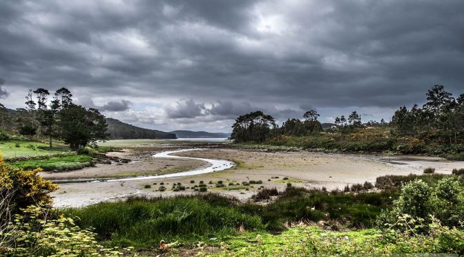
This stage is the longest of all the route, the one whose parts run along roads and it will take us around 10 hours. In spite of all this, we love it. J After enjoying the show the open sea has provided us with in the previous two stages between Laxe and Camariñas, today we have to go inland. Everything changes.
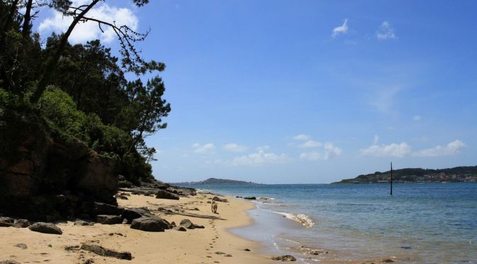
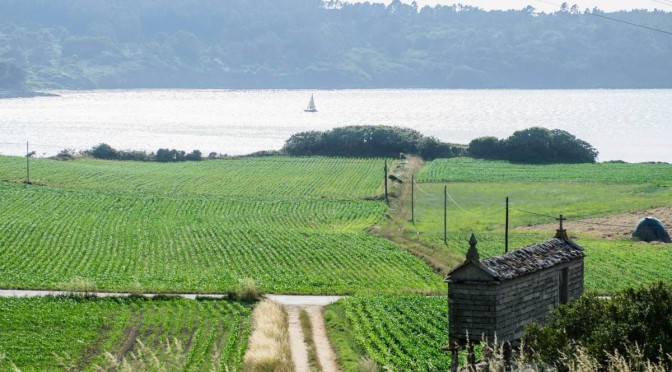
The beginning of this stage, that will take us along the Bay of Basa and the mouth of the Río Grande, shows us again the different landscapes this Camiño dos Faros contains. We can see shellfish farmers working in this calm sea, which is rich in shellfish, especially cockles, when the tide is low among flocks of egrets and some other birds that look for shelter and food in this area.
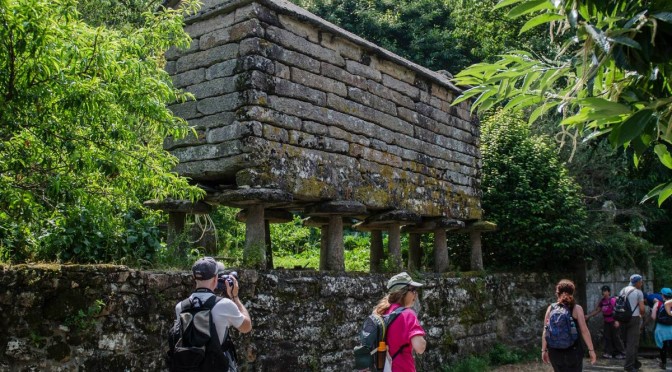
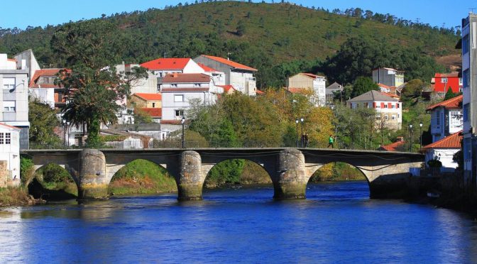
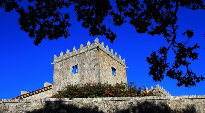
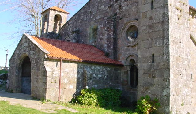
When we reach the beach Ariño, we cannot access the upper river Grande along its banks. We have to get the road to go across Tasaraño, Dor, Allo, and get to the bridge Porto, where we will go across all the river walk heading to Cereixo. There, in just a small surface, we can enjoy an amazing walk seeing a tide mill, the church Santiago, and an impressive oak and the Towers of Cereixo.
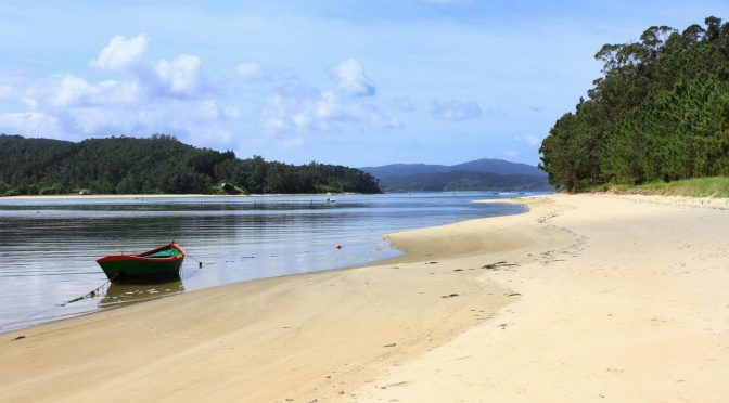
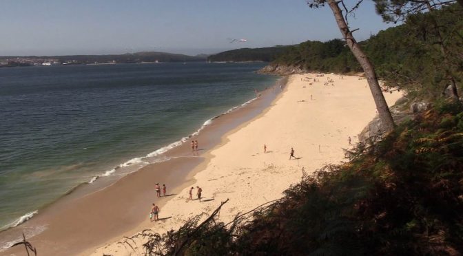
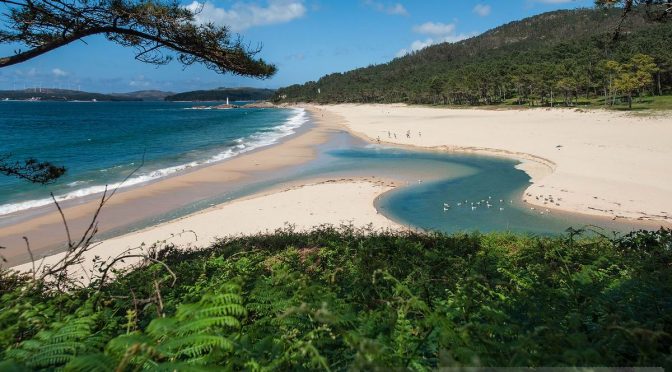
From that point, the route gets harder till we get to the beach Lago. We have to walk along the road till we turn off along a forest heading the beach Area Grande. We will descend to it to arrive again at the mouth of the river Grande. We will walk across the beach and ascend along the pine grove to reach the beach Leís, that we will also walk across but in this case being very careful as there are a lot of rocks to get at the lighthouse of the beach Lago, a place where we will enjoy a deserved bath and rest, before facing the second part of this long stage. If you decide to divide the stage in two parts, the beach Lago is the best place to finish.
We leave the beach Lago by walking along the road under the bridge and we take a small path on the right that will take us close to Merexo. We will walk along this path that goes across the center of the village with panoramic views of its small bay. From that point we head to Os Muíños where we will do the beautiful route of the mills belonging to the river Negro, a group of mills that have been rehabilitated that connect a 1,500-meter stretch with the beach.
At the end of this route we see the beach Os Muíños, one of the most visited of the area, that we have to walk till the end by taking a steep hill leading to Chorente. Right here there is the possibility of going to the Monastery of Moraime and from there connect with Chorente via El Camino de Santiago (“The Way of Saint James”).
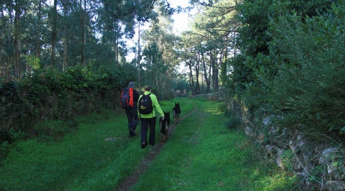
From Chorente, the route takes us along the forest of Chorente and the point with the same name from where we can see Muxía, known as the wind´s girlfriend, which we will reach after walking along the beaches Espiñeirido and A Cruz.
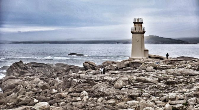
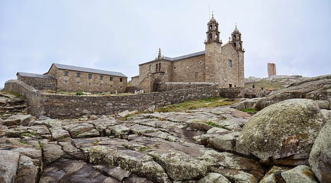
We will walk along Muxía towards the Church Santa María to reach the summit of the MountCorpiño from its bell tower to enjoy another amazing view of this Camiño dos Faros. From that point, we descend towards la Punta da Barca with the lighthouse, the sanctuary of “A Virxen da Barca” and all its stones that make of this place a magical place. If the weather conditions are good, we suggest you reaching this place before the nightfall to enjoy one of the most amazing sunsets in A Costa da Morte.
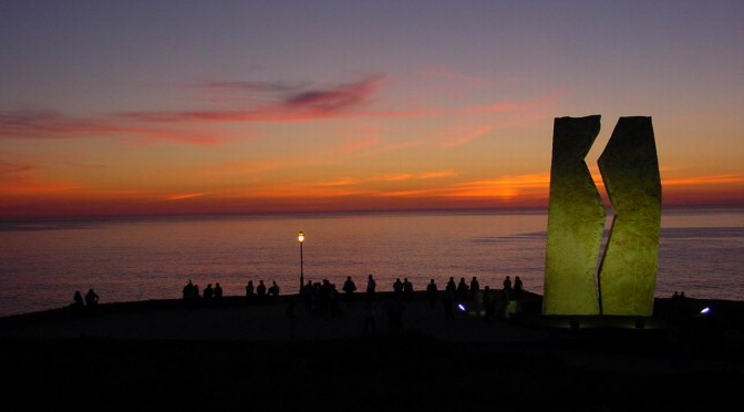
But the stage doesn´t finish here, there is 1 kilometer left along which we will walk along the Eastern side of Muxía from the monument devoted to the volunteers to the beach O Coido, the ground zero of the tragedy of the Prestige and the last part of this 6th stage of O Camiño dos Faros.
VIDEOS SECTION 6
PHOTO REPORTS SECTION 6
1st & 2nd Edition
3rd Edition
5th Edition