
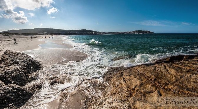
The Estuary of Anllons River begins the third stage that will take us into the constructions of our ancestors in Borneiro and Dombate, before of Mount Castelo de Lourido, top of this Camiño dos Faros. From there, we will go down to the estuary again to visit the spectacular coast of Cabana, full of furnas and charming beaches. From Punta do Cabalo we will arrive at Laxe, where we will cross its beach to finish the stage.
Download the track of the stage at Google Maps or Wikiloc


PLANNING SECTION 3 (it´s given in kilometers)
| POINT | KME | HOUR | DIF | PEL | AGU | TIME | KMM |
|---|---|---|---|---|---|---|---|
| SECTION 3: PONTECESO – LAXE (25,4 Km) | 2 | 9 h | 48.4 | ||||
| Subsection 3-1: Ponteceso – O Curro (3,3 Km) | 1 | 2 | 45′ | 48.4 | |||
| Departure Ponteceso bridge | 0 | 10:00 | FUE | 48.4 | |||
| Crossing of Apligasa | 1.1 | 10:15 | 2 | 49.5 | |||
| San Sebastian Mount | 2.2 | 10:30 | 50.6 | ||||
| Mount of Pías | 2.8 | 51.2 | |||||
| O Curro (Neaño) | 3.3 | 10:45 | FUE | 51.7 | |||
| Subsection 3-2: O Curro – As Grelas (3,6 Km) | 0 | 0 | 60′ | 51.7 | |||
| Urixeira Beach | 3.8 | 11:00 | 52.2 | ||||
| Pendón Square | 5.1 | 53.5 | |||||
| A Telleira | 5.4 | 53.8 | |||||
| Inlet of Lodeiro (As Grelas) | 6.6 | 11:45 | 1 | 55.0 | |||
| Subsection 3-3: As Grelas – Borneiro (3,0 Km) | 1 | 1 | 45′ | 55.3 | |||
| Mills stream (inicio) | 6.9 | 11:45 | 55.3 | ||||
| Runcadoiro Mills | 6.9 | 55.3 | |||||
| Forest of Runcadoiro Mills | 7.9 | 56.3 | |||||
| Crossing End Muiños stream loop pass 1 | 9.9 | 12:30 | 58.3 | ||||
| Subsection 3-4: Borneiro – Castelo Mount (5,0 Km) | 1 | 0 | 105’+60′ | 58.3 | |||
| Castro of Borneiro (15′ stop) | 10.6 | 12:30 | FUE | 15′ | 59.0 | ||
| Crossing End Muiños stream loop pass 2 | 11.3 | 13:00 | 1 | 59.7 | |||
| Vilaseco | 11.5 | 13:15 | 59.9 | ||||
| Dolmen of Dombate (15′ stop) | 12.3 | 13:30 | 15′ | 60.7 | |||
| Fontefría spring water | 13.3 | FUE | 61.7 | ||||
| Fontefría | 13.5 | 14:15 | 61.9 | ||||
| Castelo Mount (30′ stop + picnic) | 14.9 | 14:45 | 2 | 30′ | 63.3 | ||
| Subsection 3-5: Castelo Mount – Rebordelo Beach (5,2 Km) | 1 | 1 | 45′ | 63.3 | |||
| Descent to Canduas | 15.5 | 15:30 | 63.9 | ||||
| Canduas | 16.7 | 15:45 | 65.1 | ||||
| Taboído | 17.5 | 1 | 65.9 | ||||
| Crossing Taboido Forest | 18.1 | 16:00 | 66.5 | ||||
| Furna de Escanavada | 18.7 | 67.1 | |||||
| Punta de Canduas | 18.9 | 67.3 | |||||
| Punta of Castelo Island | 19.5 | 67.9 | |||||
| Rebordelo Beach (30′ stop) | 20 | 16:30 | 30′ | 68.4 | |||
| Subsection 3-6: Rebordelo Beach – Laxe Square (5,3 Km) | 2 | 2 | 120’+30′ | 68.4 | |||
| Punta da Catuxa | 20.3 | 68.7 | |||||
| San Pedro Beach | 20.6 | 69.0 | |||||
| Portiño de Filgueiras | 21.5 | 69.9 | |||||
| Punta do Cabalo | 21.6 | 70.0 | |||||
| Punta Rubia | 22.2 | 70.6 | |||||
| Puntal dos Muiños | 22.6 | 3 | 71.0 | ||||
| Coido of Frexufre Mills | 22.8 | 18:00 | 1 | 2 | 71.2 | ||
| Punta da Area | 23.5 | 18:15 | 71.9 | ||||
| Cabo da Area | 23.8 | 72.2 | |||||
| Laxe Beach | 23.9 | 18:30 | 72.3 | ||||
| Laxe Square | 25.3 | 19:00 | 73.7 | ||||
KME – Kilometers of the section
TIME – The schedule that appears in the documentation is the perfect time to walk the path, taking the section calmly, enjoying the landscapes and making the necessary stops. The departure is always recommended at 10:00 A.M..
PEL (Danger) – Danger of the section (0: Nil; 1: Low; 2: Medium; 3: High)
DIF (Difficulty) – Difficulty of the section (0: Nil; 1: Low; 2: Medium; 3: High)
AGU (Water) – Presence of Water (FUE: Source; BAR: Bar; REG: Stream)
TIE (Time) – Time of walking or stop
KMM – Total kilometers from Malpica
DESCRIPTION SECTION 3
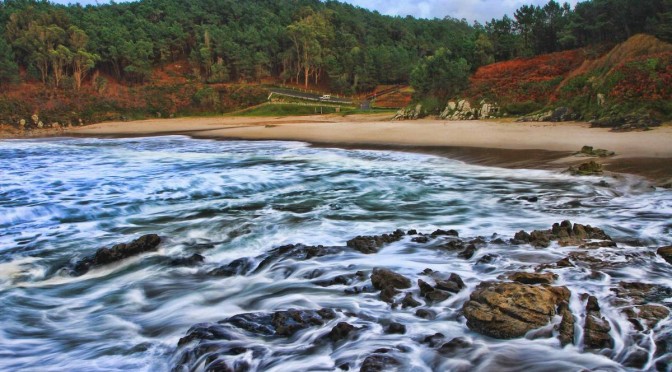
The 3rd stage of O Camiño dos Faros takes us along the coast and to the inland of Cabana to finish in Laxe.
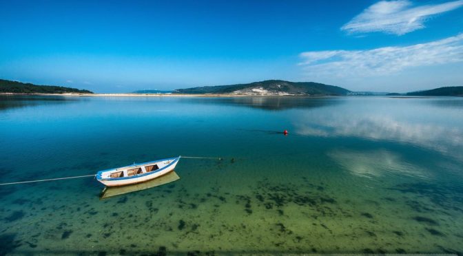
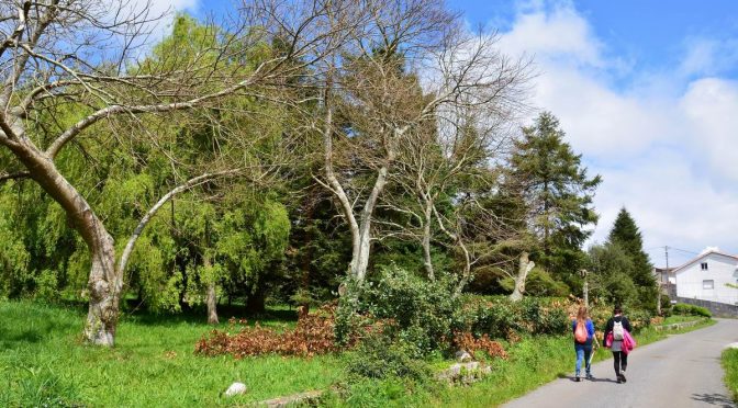
The 1st kilometer goes along the hard shoulder of the main road that we walk across by taking a crossing point on our right to get to the Bay Insua and walk along its pinegroves till Neaño and the beach Urixeira. From there, a 3-km walk starts till O Lodeiro where we can still watch a great amount of birds that have their habitat in this estuary of the River Anllóns.
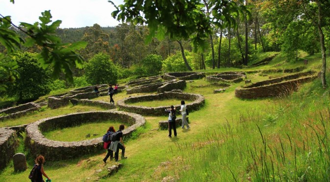
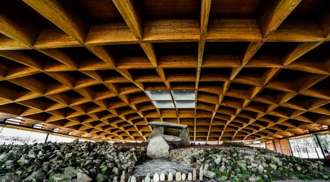
At the end of this walk, when reaching As Grelas, we walk towards the inland by taking a very hard ascent following the route of “Rego dos Muíños” till the Castro A Cibda and the Dolmen Dombate, two amazing archeological pieces in A Costa da Morte.
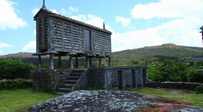
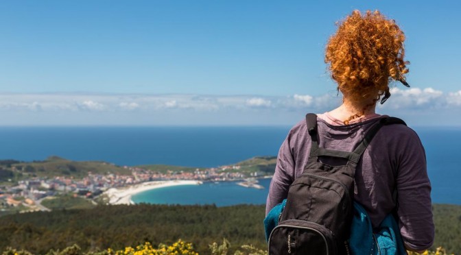
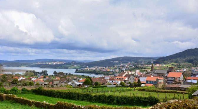
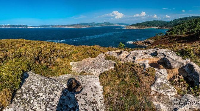
From Dombate we go towards the coast again, turning off in Fontefría to ascend to the Castle of Lourido, which is the summit of this Camiño dos Faros with 312 meters high. From there we can enjoy the most amazing views of the “Ría of Corme and Laxe”.
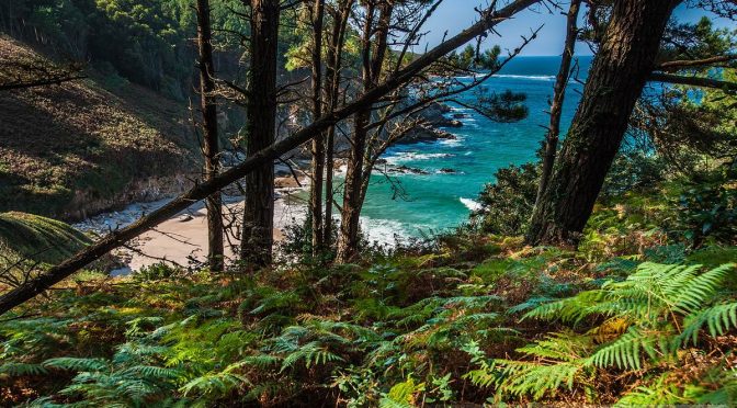
From this summit, we descend across Canduas towards the Beach Area das Vacas, which we will never reach as we take a crossing point that takes us across the pine yards and eucalyptus to the Rebordelo beach, where we suggest having a stopover.
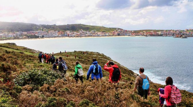
The last part of this stage takes us to Punta do Cabalo, from where we can see Laxe kind of close. We will reach Laxe by walking along its beach and promenade till the village square, which is the end of this 3rd stage of O Camiño dos Faros.