Tag Archives: Villages

Os Muiños

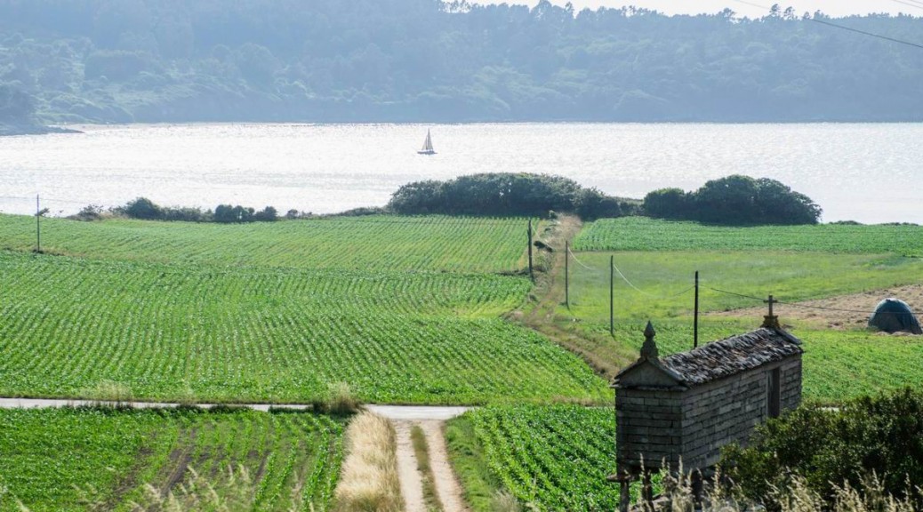
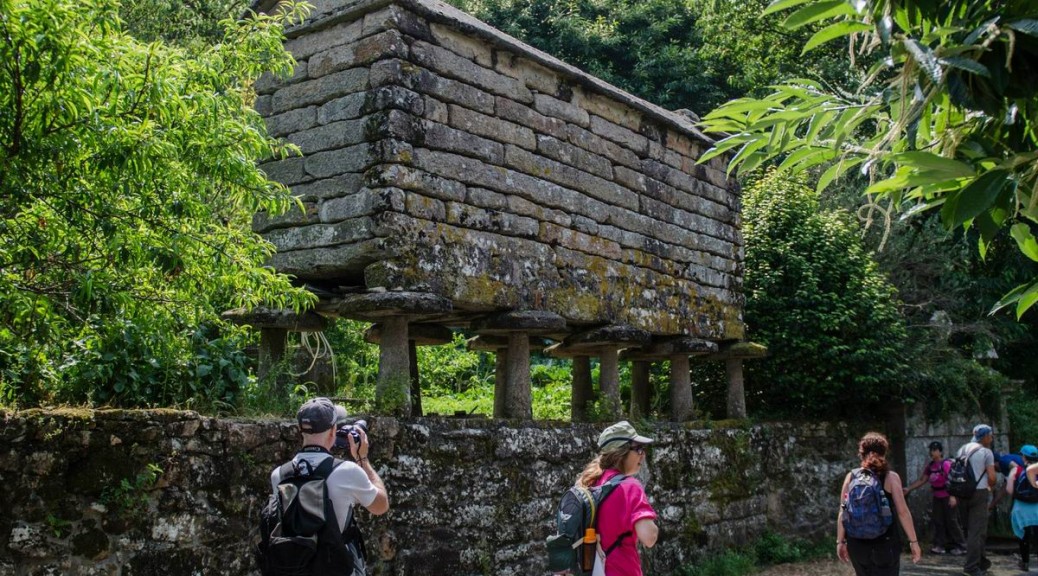
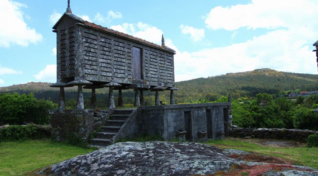
Os Muíños is another typical village that is very well cared of in this Costa da Morte. We walk not only by “hórreos”, which are used to keep the harvest, but also by old stone houses looking for a turning point on the right that will take us close to the beach, one of the best ones in the municipality, by taking the route of the mills.

On our way to the mills, we see another of the wonders this Camiño dos Faros provides us with and we do love taking photos of,that is the scarecrow hanging from the trees, that gets surprised when it sees the Trasnos walking along this area.


The Route of the Mills of Río Negro is small and it is very well cared of. At the beginning of all the walk we see the Fonte da Tella (“the Fountain of the Tile”), a fountain with very fresh water and we will rest next to it. 50 meters up, the river descends forming a small waterfall on another unique spot.


Here we have to face again a problem we have dealt with in the previous kilometers. These boardwalks that are placed in shady places are full of moss and it is impossible to walk over them. However, we do it and although we do it very careful we don’t stop enjoying the beauty of this river Negro whose name matches the appearance of the place.

Along the walk we see several restored mills that in autumn, provide us with images like these ones …. As we have already said, O Camiños dos Faros, is a landscape in every step.


At the end of the route, in the mouth of the river, we descend some difficult steps to reach the beach of Os Muíños, one of the most visited in this municipality in summer. It is in a quiet bay and it has all the necessary services, which makes of this place the perfect spot to go with children.

As many of the beaches in this Costa da Morte, it is surrounded by some dunes with vegetation.

From this point, we have the option to visit the Monastery of Moraime and walk part of the St. Jame´s Way till Chorente. The other option, that is the one we follow in this Camiño dos Faros, is to go on by taking a path that is at the end of the beach and that will take us directly to Chorente by a steep hill.

Merexo

When we were discovering the route we were trying to link all the points along the coastline of Merexo. There is a fish farm of turbot called Prodemar belonging to the multinational Stolt Sea Farm. There are some plans to make it bigger, however, we the tTasnos wish they didn´t carry out these projects which can end up spoiling our environment. Let´s keep in good condition what nature provides us with, it is a treasure! Next to the fish farm, a “cetárea”, sells all kind of seafood.

Linking all the points along the coast of Merexo was not easy and, besides, the final route wouldn´t provide us with anything that special. So, we decided to design O Camiño dos Faros along the main street of the village, which implies saving some kilometers and this design will allow us to see a typical rural settlement as Merexo is, with its stone streets. Its inhabitants are really surprised when they see the Trasnos walk across their village.

At the end of the village we walk towards Os Muíños, it is about 1 kilometer and a half that coincides with O Camiño dos Faros.

Getting into the rural area

O Camiño dos Faros is a coastline route but, in some stretches, we are forced to walk along the inland. This is one of them, but it is worthwhile.  A stretch that is not longer than 2 kilometers from Tasaraño to Allo that takes us to a rural atmosphere that is still successfully facing all economic crises.

When we arrive in Tasaraño we have a fountain where we can refresh ourselves and get fill up again our bottles. Next to it, a horse chestnut and a stoned “hórreo” similar to the great deal of them we are going to see, as important to store the cereals for the livestock.

When we walk along Dor we can check again what happens all along this route. Another typical Galician village that keeps its past, a past that we should never forget.

After walking across the forest we arrive in Allo, where we will walk across the road in front of the school, which is already in Ponte de Porto.

Canduas

From the castle of Lourido we descend by taking a dirty track that will lead us till Canduas through Arnela.

Along the way, we can see small and big houses in very good condition and some of them that have been renovated. Most of them are surrounded by plants and a big amount of citrus trees. 
 

Canduas emerged around the Monastery of San Martiño in Canduas. It dates back to the 14th century, and it was annexed to the Monastery of San Martiño Pinario in Santiago. There are no remains of the old monastery. The rectory house was built above it and the façade of the Church of San Martiño was covered by using the stones of the “hórreo”. This façade faces the North.

In our route, apart from the Church we can also see the House of Romero and its stone cross.

Fontefría

We left Dombate and we headed to Fontefría to reach the summit of O Camiño dos Faros: The Castle Lourido. In Fontefría, we can fill up our bottles in the fountain that it is before reaching the village.

Along the way, we meet with the farmers that prepare the silos (kind of storage places for holding grain) to stock the food that will feed the animals in winter.

Vilaseco

On our way to Dombate, we get to Vilaseco, a typical village in the inland of Bergantiños. We can see big “horreos” built in wood or stone that were and still are used to keep the corn and cereals.

When we are leaving the village, we can see a farm with Galician Friesian cows, one of the few livestock farms in this Camiño dos Faros.

From that point, we will take the road that will lead us to the “Dolmen” in Dombate. It will take us only a few minutes to get there.

The Village of O Roncudo

The small village O Roncudo shows us an architecture based on the use of the same stone and perfectly adapted to the wind and to the rough weather. There are big walls made of stone that shelter its inhabitants from the rough winter. In Touriñán we will see the same kind of structures.

These small groups of houses that are scattered along this area, isolated from the rest of villages can help us to imagine the kind of life its inhabitants underwent decades ago without electricity, without being able to move from one place to another when the rough weather hit them. Can you imagine that?

We were walking along O Roncudo passing by a young man who jumped surprisingly when he saw us. There are not many people who are able to “see” us, but he definitely did.

-“What are you doing here, Trasniños?” – he asked with the typical accent of the area.

-“We are doing O Camiño dos Faros, 200 kilometers along the coastline from Malpica to Finisterre. We are walking and let´s see when we get there”

-“O.K., it sounds amazing. My name is Suso. What´s yours?”

-“We are Xiña, Nemiño e Traski”- we answered.

“O.K. So, if you wait for a second, I will leave the barnacles in one of my friend´s house and I will walk with you till the lighthouse”

Suso is a barnacle fisher and one of the people that know the area the best. He was going to tell us the History of O Roncudo as nobody could have ever told us.

http://susolista.blogspot.com.es/2006/08/ronca-o-mar-en-roncudo.html

We walked along the village and we left it taking the paths where the windmills are towards the lighthouse. We were listening to all the stories, Suso was telling us about the rough sea that hits the best rocks where to fish the best barnacles. Time with him, literally, flew away.