
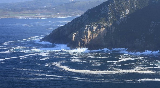
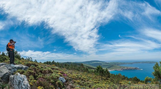
The coast from Muxía to the Touriñán Lighthouse is a rugged and almost inaccessible coast that the trasnos managed to join creating a spectacular route. We are in the hardest part of the trail and we must take it calmly until we reach Praia de Moreira. From there, the section softens to the Touriñán Lighthouse, the westernmost point of peninsular Spain, and the Nemiña Beach, the end of this section that leaves no one indifferent.
Download the track of the stage at Google Maps or Wikiloc


PLANNING SECTION 7 (it´s given in kilometers)
| POINT | KME | HOUR | DIF | PEL | AGU | TIME | KMM |
|---|---|---|---|---|---|---|---|
| SECTION 7: MUXIA – NEMIÑA (25,3 Km) | 3 | 9h 15′ | 148.1 | ||||
| Subsection 7-1: Coido Beach – Pista Arnela (5,0 Km) | 3 | 1 | 75’+15′ | 148.1 | |||
| Departure Coido Beach | 0 | 10:00 | 148.1 | ||||
| Crossing Lourido Beach | 1.7 | 1 | 149.8 | ||||
| Lourido Beach | 1.7 | 10:15 | 149.8 | ||||
| Parador da Costa da Morte | 2.2 | 150.3 | |||||
| Punta Lourido | 4.3 | 10:35 | 152.4 | ||||
| Ascent Cachelmo Mount (750m, 23%) | 3.1 | 3 | 151.2 | ||||
| Cachelmo Mount (15′ stop) | 3.8 | 11:00 | 15′ | 151.9 | |||
| Turn left Arnela path | 4.9 | 11:30 | 153.0 | ||||
| Subsection 7-2: Pista Arnela – Coido of Cuño (4,7 Km) | 2 | 2 | 105’+15′ | 153.0 | |||
| Pista Punta Buitra | 5.4 | 11:45 | 153.5 | ||||
| Punta Buitra | 7.2 | 12:15 | 155.3 | ||||
| High of Punta Buitra | 7.5 | 12:30 | 155.6 | ||||
| Campo Corocho | 8.3 | 156.5 | |||||
| Punta dos Penedos | 8.8 | 1 | 2 | 156.9 | |||
| Coido of Cuño | 9.6 | 13:15 | 2 | 157.7 | |||
| Cuño stream (15′ stop) – Turn left | 9.6 | 13:15 | REG | 15′ | 157.7 | ||
| Subsection 7-3: Coido of Cuño – Moreira Beach (3,9 Km) | 3 | 1 | 120’+45′ | 157.7 | |||
| Cuño Forest (ascent 2000 m, 13%) | 9.9 | 158.0 | |||||
| Campo das Moas | 10.8 | 158.9 | |||||
| Pedrouzo Mount (15′ stop) | 11.6 | 14:45 | 15′ | 159.7 | |||
| Ribeira de Viseo | 11.8 | 15:00 | 159.9 | ||||
| Turn right descent to Moreira Beach (descent 600 m, -21%) | 12.9 | 3 | 161.0 | ||||
| Moreira Beach (30′ picnic) | 13.6 | 15:45 | 30′ | 161.7 | |||
| Subsection 7-4: Moreira Beach – Touriñán Loop Point (2,9 Km) | 1 | 0 | 45′ | 161.7 | |||
| As Filgueiras | 14.5 | 16:30 | 162.6 | ||||
| Fields of Touriñán | 15.1 | 163.2 | |||||
| Touriñán Loop Point Pass 1 | 16.4 | 17:00 | 164.5 | ||||
| Subsection 7-5: Circular Touriñán Lighthouse (4,5 Km) | 1 | 1 | 45’+30′ | 164.5 | |||
| Turn right Touriñán path | 17.4 | 17:15 | 165.5 | ||||
| Punta Gavioteira | 18.1 | 166.2 | |||||
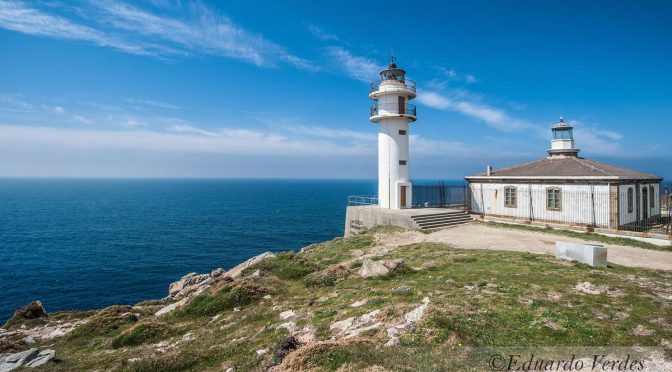
| Touriñán Lighthouse (30′ stop) | 18.9 | 17:30 | 30′ | 167.0 | |||
| Punta da Insua (Herboso Island) – Westernmost point | 19.4 | 18:00 | 167.5 | ||||
| Coido of Touriñán | 20.6 | 18:15 | 168.7 | ||||
| Touriñán Loop Point Pass 2 | 20.9 | 18:15 | 169.0 | ||||
| Subsection 7-6: Touriñán Loop Point – Nemiña Beach (4,3 Km) | 1 | 1 | 60′ | 169.0 | |||
| Touriñán exviewpoint | 22.7 | 18:45 | 170.8 | ||||
| Turn right Talón | 23.6 | 171.7 | |||||
| Talón | 24.3 | 19:00 | 172.4 | ||||
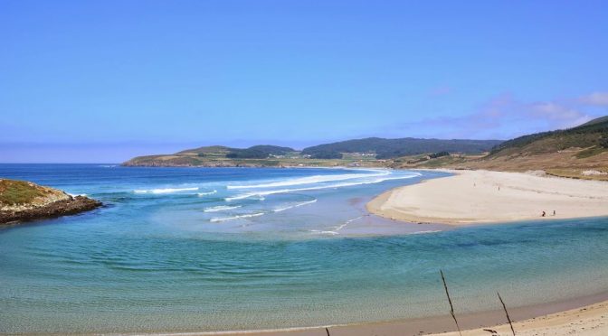
| Nemiña Beach | 25.3 | 19:15 | 173.4 | ||||
KME – Kilometers of the section
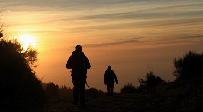
TIME – The schedule that appears in the documentation is the perfect time to walk the path, taking the section calmly, enjoying the landscapes and making the necessary stops. The departure is always recommended at 10:00 A.M..
PEL (Danger) – Danger of the section (0: Nil; 1: Low; 2: Medium; 3: High)
DIF (Difficulty) – Difficulty of the section (0: Nil; 1: Low; 2: Medium; 3: High)
AGU (Water) – Presence of Water (FUE: Source; BAR: Bar; REG: Stream)
TIE (Time) – Time of walking or stop
KMM – Total kilometers from Malpica
DESCRIPTION SECTION 7
As you have arrived at this stage, you are supposed to be in fit to do the following two stages left to arrive in Finisterre. This penultimate stage is the most demanding one of this Camiño dos Faros, mainly at the beginning, along the 10 kilometers from Lourido to Moreira with loads of ascents and descents.
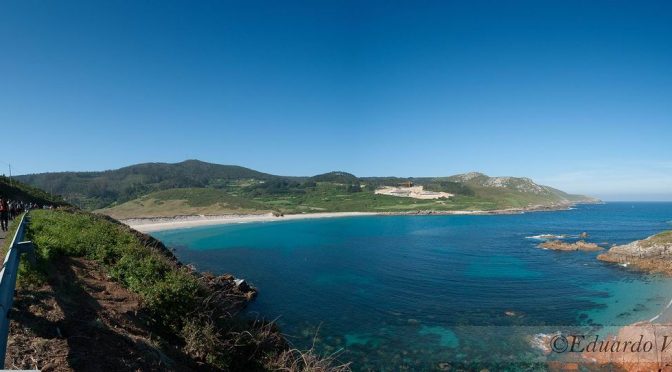
We leave Muxía across O Coído and we walk across the beach of Lourido till we reach the Coído da Agra. From this point we start ascending to the MountCachelmo (750 meters up from 0 to 150 meters, with an average gradient of 23%). Up there, in the mountCachelmo we enjoy amazing views of Muxía with Vilán in the foreground, and of Point Buitra with Touriñán.
From that spot, we start a kind of difficult descent that will take us to the beach of Arnela. From this beach, we will ascend to the track that takes us to the end of Point Buitra and to the summit of the mount with the same name, from which we see the panoramic view of the rest of the stage, with Cuño, O Pedrouzo, Moreira, and all the peninsula that forms the CapeTouriñán.
We choose a place somehow near the antenna that is in Point Buitra to start a descent to the Coído do Cuño whose last stream is a good place to have something to eat and drink and SPA.
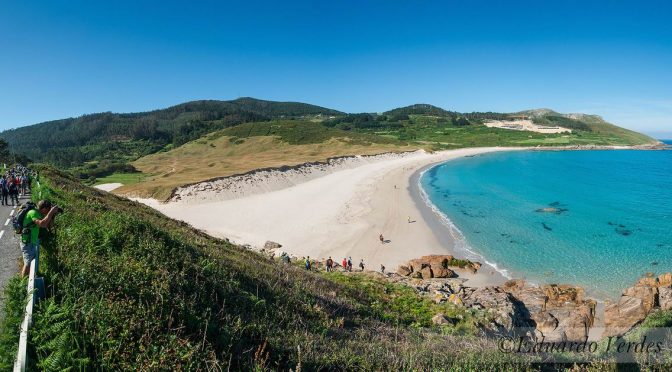
From Cuño, we start the ascent to the 264-meter MountPedrouzo (2 kilometers ascending with an average gradient of 13%). When we get to the top and after a rest that we actually deserve, we start the descent to the beach Moreira that is also very technique, with a rugged land and an average gradient in some stretches of 25%.
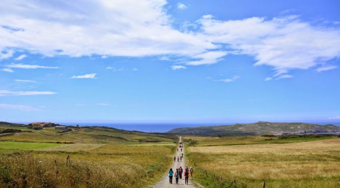
When we get to the beach Moreira, the stage starts being less difficult in this second part. From Moreira a dirty track takes us to Touriñán. We will arrive there by getting the right side to the lighthouse of Touriñán, the westernmost point of this Camiño dos Faros, and on many days, where the sun sets the last in Europe.
In the last part of this stage, we will walk along Insua and the Coído de Touriñán to get to the Mirador. There is a road at this point that will take us close to the beach Nemiña, walking across the village Talón. It is the beach Nemiña, the penultimate stage.
VIDEOS SECTION 7
PHOTO REPORTS SECTION 7
1st & 2nd Edition
3rd Edition
5th Edition