
In this stage we will pass through the heart of O Camiño dos Faros and A Costa da Morte. A steep coast that we will cover all over, stopping at each point and contemplating the virginity of its landscapes. The small Porto de Santa Mariña gives us access to Praia de Trece and the Cemetery of the English. From there, through a very comfortable section, we reach the Vilán Lighthouse, a key point on this road. The end of the stage runs through the entire Arco do Vilán to Camariñas.
Download the track of the stage at Google Maps or Wikiloc


PLANNING SECTION 5 (it´s given in kilometers)
| POINT | KME | HOUR | DIF | PEL | AGU | TIME | KMM |
|---|---|---|---|---|---|---|---|
| SECTION 5: AROU – CAMARIÑAS (23,7 Km) | 2 | 9h | 91.7 | ||||
| Subsection 5-1: Arou Beach – Lobeiras Beach (1,8 Km) | 1 | 1 | 45′ | 91.7 | |||
| Departure Arou Beach | 0 | 10:00 | 91.7 | ||||
| Arou spring water | 0.5 | FUE | 92.2 | ||||
| Crossing Xan Ferreiro Inlet | 1 | 92.7 | |||||
| Xan Ferreiro Inlet | 1 | 92.7 | |||||
| Lobeiras viewpoint | 1.7 | 10:30 | 93.4 | ||||
| Lobeiras Beach | 1.8 | 93.5 | |||||
| Subsection 5-2: Lobeiras Beach – Port of Santa Mariña (2,1 Km) | 2 | 2 | 60′ | 93.5 | |||
| O Pelouro | 2.1 | 93.8 | |||||
| Os Boliños | 2.6 | 94.3 | |||||
| Pedra do Sal | 3.3 | 95.1 | |||||
| Coido of Cabanas | 3.7 | 95.4 | |||||
| Port of Santa Mariña | 3.9 | 11:30 | 95.6 | ||||
| Turn right Santa Mariña | 4.1 | 95.8 | |||||
| Subsection 5-3: Port Santa Mariña – English Cemetery (4,5 Km) | 2 | 1 | 90’+45′ | 95.8 | |||
| Coido of Colludo | 4.3 | 2 | 1 | 96.0 | |||
| Cape Veo (15′ stop) | 5.5 | 12:15 | 2 | 15′ | 97.2 | ||
| Penal de Veo | 5.8 | 97.5 | |||||
| Branco Mount Dune of Camariñas | 6.3 | 98.0 | |||||
| Trece Beach | 6.4 | 12:40 | 98.1 | ||||
| English Cemetery (30′ picnic) | 8.5 | 13:30 | 30′ | 100.2 | |||
| Subsection 5-4: English Cemetery – Vilan Lighthouse (7,5 Km) | 1 | 1 | 105’+60′ | 100.2 | |||
| Punta Boi | 8.7 | 100.4 | |||||
| Turn right Reira beaches | 11.2 | 14:30 | 102.9 | ||||
| Reira Beach | 11.3 | 103.0 | |||||
| Bear’s Stone | 11.6 | 103.3 | |||||
| Area Longa Beach | 11.7 | 103.4 | |||||
| Balea Beach | 12.3 | 104.0 | |||||
| Departure path of Reira | 12.6 | 104.3 | |||||
| A Pedrosa | 13.7 | 15:15 | 2 | 105.4 | |||
| Turn right wind turbine Vilán | 15.2 | 106.9 | |||||
| Vilan Lighthouse (60′ stop) | 15.9 | 15:45 | BAR | 60′ | 107.6 | ||
| Old Vilan Lighthouse | 16 | 107.7 | |||||
| Subsection 5-5: Vilan Lighthouse – Hermitage of Virxe do Monte (4,1 Km) | 1 | 1 | 75′ | 107.6 | |||
| Punta Esperillo | 16.6 | 17:00 | 108.3 | ||||
| Vieita spring water (at 250 m. of the path) | 17.6 | FUE | 109.3 | ||||
| A Coenda | 19.2 | 110.9 | |||||
| Turn right Football field | 19.7 | 111.4 | |||||
| Hermitage of Virxe do Monte | 20 | 18:00 | 111.7 | ||||
| Subsection 5-6: Hermitage of Virxe do Monte – Camariñas (3,7 Km) | 1 | 1 | 60′ | 111.7 | |||
| Punta Corveiro de Lago | 20.5 | 112.2 | |||||
| Lago Beach in Camariñas | 20.9 | 112.6 | |||||
| Soberano’s Castle | 23.1 | 114.8 | |||||
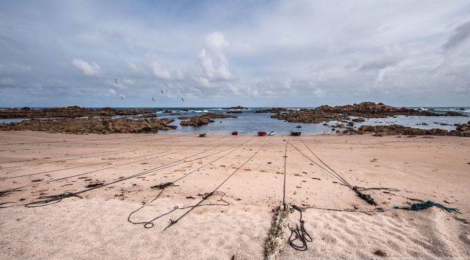
| Fishing port in Camariñas | 23.5 | 18:45 | 115.2 | ||||
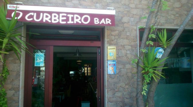
| Curbeiro Square | 23.8 | 19:00 | 115.5 | ||||
KME – Kilometers of the section
TIME – The schedule that appears in the documentation is the perfect time to walk the path, taking the section calmly, enjoying the landscapes and making the necessary stops. The departure is always recommended at 10:00 A.M..
PEL (Danger) – Danger of the section (0: Nil; 1: Low; 2: Medium; 3: High)
DIF (Difficulty) – Difficulty of the section (0: Nil; 1: Low; 2: Medium; 3: High)
AGU (Water) – Presence of Water (FUE: Source; BAR: Bar; REG: Stream)
TIE (Time) – Time of walking or stop
KMM – Total kilometers from Malpica
DESCRIPTION SECTION 5
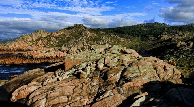
O Camiño dos Faros gets people hooked. If you have reached this stage, you have that feeling more than clear. If there is any doubt left, this is the stage that includes one of the best hiking-trails that you have ever done, on a coast that is extremely rugged and full of history.
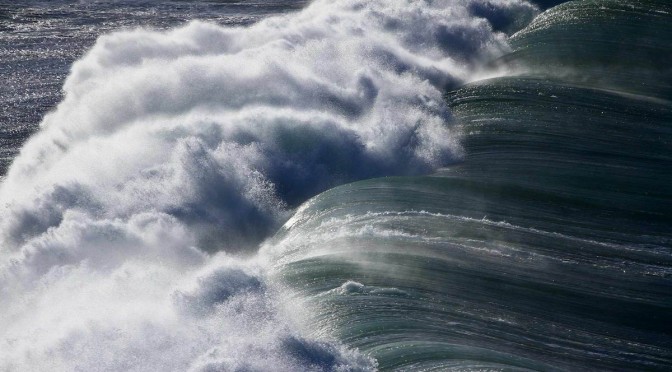
The part of the coast that goes from Arou to CapeVilán is the beginning of everything. Some wrecks suffered from vessels belonging to the British Navy at the end of the 19th century and the beginning of the 20th century, with loads of casualties in the Serpent were the reason why this coast is called A Costa da Morte (the coast of the death).
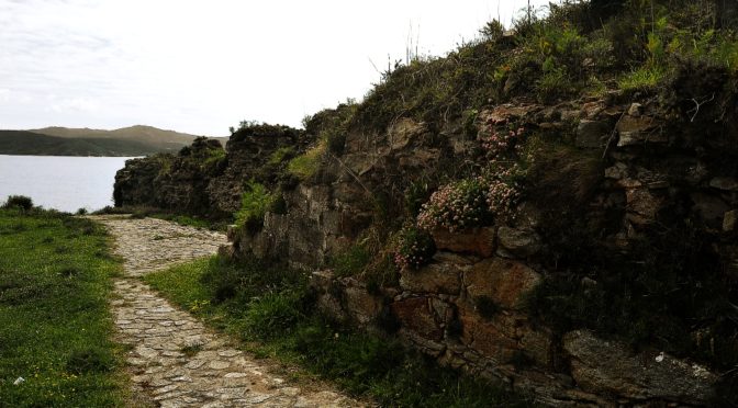
Along the route, we are going to have evidences of such a name. Hundreds of “ killer restingas” (straight spit of land extending towards the sea) get into the sea that never lets up, a sea that doesn´t understand only works…
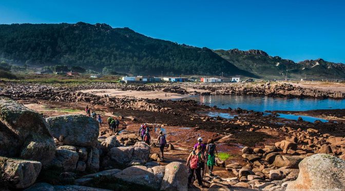
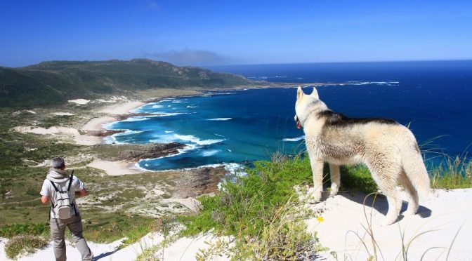
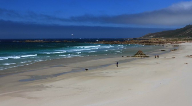
We left Arou early in the morning and we went to the viewpoint in Lobeiras by walking along the bay and we stopped by also on the beach Lobeiras. From there, by walking along a path full of gorse bushes we walk along the “coídos” (small coves full of ball-shaped stones) in the middle of a unique landscape, till we get to the port Santa Mariña that we will go across to ascend the dune in MountBlanco. Once again, when we get to the summit we will enjoy some amazing views of O Camiño dos Faros with the dune, the beach Trece (“thirteen”), all the Point Boi and the Cemetery of the English.
We are in the middle of O Camiño dos Faros, 100 kilometers already done, 100 kilometers still left, but from this point what we feel is that we are in the heart of the route.
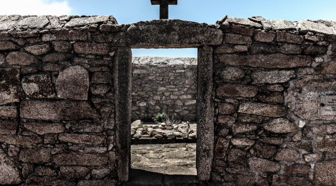
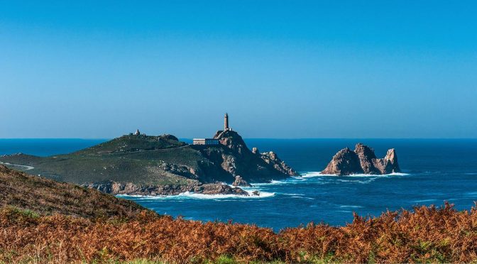
When descending, we go across small and isolated coves from the beach Trece till Point Boi. At this point the sea hits the coast with strength and we can see the Cemetery of the English, where the casualties of the Serpent are buried. In the foreground we can see CapeVilán, although we will need two hours to get there.
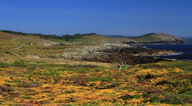
The route from Point Boi to Vilán takes us along all the beaches in Reira, by walking an easy path that runs down this wild and isolated coast till we ascend the MountPedroso and we get to the lighthouse Vilán.
The lighthouse Vilán is one of the symbols in this “camiño”. Since it started to be used, it has been the light guiding all the vessels that travel along this sea with an intense maritime traffic. It is, without a doubt, a magic place in this Camiño dos Faros.
From Vilán we get closer to Camariñas by taking another route that runs down the coast, walking by the chapel of the Virgin of the Mount and the Castle to finish the stage in the center of Camariñas, next to the fishing port.
VIDEOS SECTION 5
PHOTO REPORT SECTION 5
1st & 2nd Edition
3rd Edition
5th Edition