

The second section takes us through an infinite variety of landscapes from Niñóns to Ponteceso. The first inlets and lonely coves lead us to the cliffs of Cabo Roncudo and, from there, to the interior of the Ría de Corme-Laxe, where everything changes again. The Monte da Facha and the entire mouth of the Anllóns River with the dunes of A Barra complete a journey that will leave you with your mouth open.
Download the track of the stage at Google Maps or Wikiloc


PLANNING SECTION 2 (it´s given in kilometers)
| POINT | KME | HOUR | DIF | PEL | AGU | TIME | KMM |
|---|---|---|---|---|---|---|---|
| SECTION 2: NIÑONS – PONTECESO (27,1 Km) | 3 | 9h 45′ | 21.3 | ||||
| Subsection 2-1: Niñons Beach – Barda Beach (5,0 Km) | 2 | 2 | 90′ | 21.3 | |||
| Departure Niñons Beach | 0 | 10:00 | 21.3 | ||||
| Morro Beach | 0.7 | 22.0 | |||||
| Niño do Corvo Beach | 1.4 | REG | 22.7 | ||||
| Port of Santa Mariña | 2.3 | 10:45 | 23.6 | ||||
| Cliffs of Eiroa | 2.4 | 23.7 | |||||
| Punta do Pichón | 2.8 | 24.1 | |||||
| Mean Valley | 2.8 | 24.1 | |||||
| Right turn road of Santa Mariña | 3.2 | 3 | 24.5 | ||||
| Right turn start downhill path A Barda | 3.4 | 24.7 | |||||
| High of Bravio | 3.9 | 25.2 | |||||
| Barda Beach | 4.9 | 11:30 | 26.2 | ||||
| Barda spring water | 4.9 | FUE | 26.2 | ||||
| Subsection 2-2: Barda Beach – The Village of Roncudo (4,6 Km) | 3 | 2 | 120′ | 26.2 | |||
| Crossing Area Pequena | 5 | 26.3 | |||||
| Punta Espiñeira | 6.2 | 27.5 | |||||
| Punta do Castro | 7.2 | 28.5 | |||||
| Punta de Eiras | 7.9 | 29.2 | |||||
| Punta Percebellosa | 8.3 | 29.6 | |||||
| A Zorrateira | 9.3 | 30.6 | |||||
| The Village of Roncudo | 9.5 | 13:30 | 30.8 | ||||
| Subsection 2-3: The Village of Roncudo – Roncudo Lighthouse (3,4 Km) | 2 | 2 | 60’+30′ | 30.8 | |||
| Village Roncudo spring water | 9.5 | FUE | 30.8 | ||||
| O Tordeiro – Descent to the coast | 10.5 | 13:45 | 2 | 2 | 31.8 | ||
| Laxe das Pesqueiras | 11.4 | 32.7 | |||||
| Punta do Mouzón | 11.8 | 33.1 | |||||
| Furna da Fuxisaca | 12.4 | 33.7 | |||||
| Roncudo Lighthouse (30′ stop) | 13 | 14:30 | 30′ | 34.3 | |||
| Subsection 2-4: Roncudo Lighthouse – Fishing port in Corme (3,3 Km) | 1 | 1 | 45’+30′ | 34.3 | |||
| Eiruga Sea | 13.5 | 34.8 | |||||
| Aguillón Pit | 14 | 35.3 | |||||
| Gralleiras cove | 14.8 | 36.1 | |||||
| Area das Conchas cove | 15.2 | 36.5 | |||||
| Corme (30′ stop) | 16.3 | 15:45 | FUE | 30′ | 37.6 | ||
| Subsection 2-5: Corme – Valares Beach (5,4 Km) | 2 | 1 | 90’+30′ | 37.6 | |||
| Arnela Beach | 17 | 16:30 | 38.3 | ||||
| Osmo Beach | 17.3 | 16:35 | FUE | 38.6 | |||
| Ermida Beach | 18.1 | 16:45 | 39.4 | ||||
| Estrela Island | 18.7 | 40.0 | |||||
| Rio Covo Beach | 19.4 | 17:00 | 2 | 1 | REG | 40.7 | |
| Punta do Canteiro | 20.6 | 41.9 | |||||
| Facha Mount – The wall | 21 | 42.3 | |||||
| Valares Beach (30′ stop) | 21.6 | 17:45 | FUE | 30′ | 42.9 | ||
| Subsection 2-6: Valares Beach – Ponteceso (5,4 Km) | 1 | 0 | 90′ | 42.9 | |||
| Branco Mount Dune of Ponteceso | 23.3 | 18:45 | REG | 44.6 | |||
| Tiñosa Island / Anllons River sand bar | 23.3 | 44.6 | |||||
| Barra dunes | 23.3 | 44.6 | |||||
| Ornithological Observatory | 24.9 | 46.2 | |||||
| Malecón do Couto | 25.8 | 19:15 | 47.1 | ||||
| Eduardo Pondal Birthplace | 27.1 | 48.4 | |||||
| Ponteceso bridge | 27.1 | 19:45 | FUE | 48.4 | |||
KME – Kilometers of the section
TIME – The schedule that appears in the documentation is the perfect time to walk the path, taking the section calmly, enjoying the landscapes and making the necessary stops. The departure is always recommended at 10:00 A.M..
PEL (Danger) – Danger of the section (0: Nil; 1: Low; 2: Medium; 3: High)
DIF (Difficulty) – Difficulty of the section (0: Nil; 1: Low; 2: Medium; 3: High)
AGU (Water) – Presence of Water (FUE: Source; BAR: Bar; REG: Stream)
TIE (Time) – Time of walking or stop
KMM – Total kilometers from Malpica
DESCRIPTION SECTION 2
This second stage, with 26 km, goes from Niñóns to Ponteceso, covering a wide variety of different landscapes.
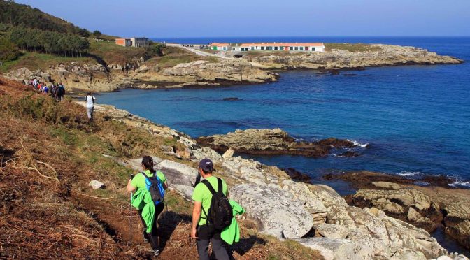
The stage begins at Niñóns beach, traveling along the cliffed coast that separates it from the Port of Santa Mariña. There, we will skirt the port to cross the mountain towards A Barda beach.
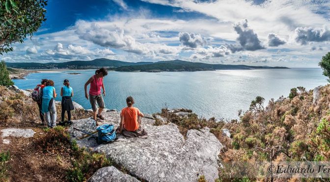
From A Barda beach, we will cross the entire Costa da Tremosa along a demanding path with privileged views that will bring us closer to the small village of Roncudo, which shows us an architecture based on the same stone and fully adapted to wind and storms.
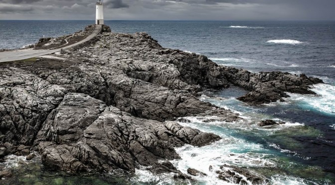
From the village we continue to descend from the wind farms along the rugged cliffs to the Roncudo Lighthouse, another of the milestones on our path. There, we can see the rocks where the barnacles risk their lives to extract this precious delicacy from the sea.
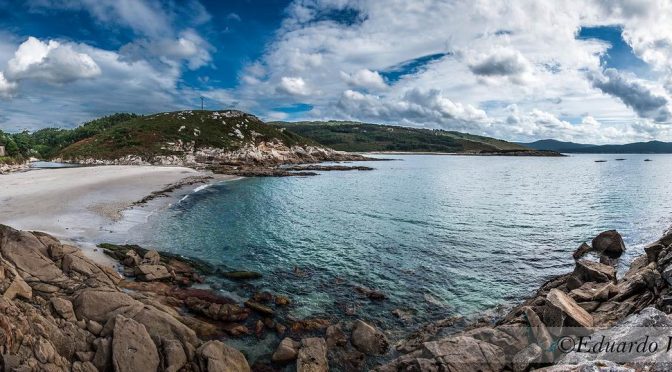
From there we headed into the interior of the estuary. We pass through the fishing port of Corme and head out towards Valarés beach, passing through the beaches of Osmo, Ermida and Río Covo. We will leave the latter along a narrow path over the estuary that brings us to the cliffs of Monte da Facha and Valarés, where we can make a stop to enjoy its beach and pine forest.
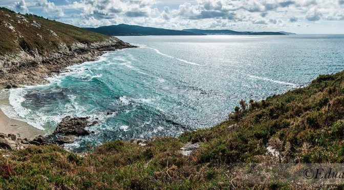
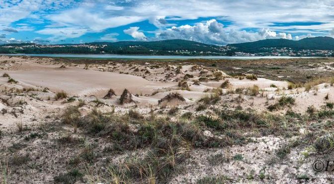
The end of the stage through Monte Branco is spectacular. The coastal route brings us to the mouth of the Anllóns, with a privileged view of the Tiñosa Island and all the dunes and the Barra beach, to which we will go down to travel this kilometer of desert in the middle of the Insua cove, a place of great importance ornithological.
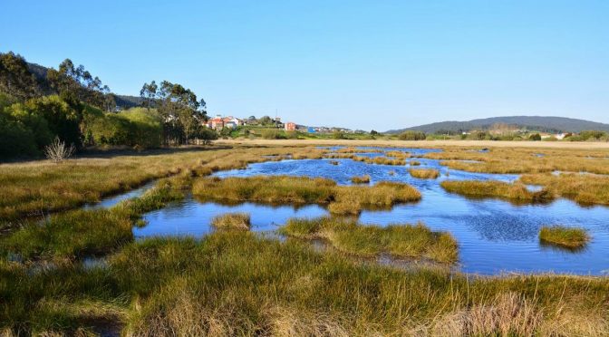
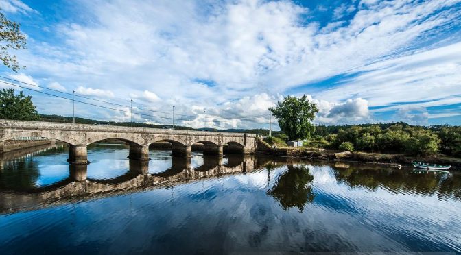
From there we will travel along the entire Malecón de Ponteceso, which separates the farmland from the river, until finishing the stage at the Ponteceso bridge, in front of the house of the poet Eduardo Pondal.
VIDEOS SECTION 2
PHOTO REPORT SECTION 2
1st & 2nd Edition
3rd Edition
5th Edition


